Answer: They are priceless if they are “heat maps” showing the concentration of poverty in Baltimore County.
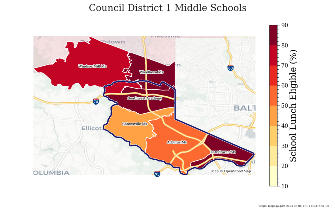
A years-long dream to create maps showing poverty concentrations, legislative districts, and the locations of public schools in Baltimore County has become a reality. These heat maps show councilmanic, state, and congressional districts, the concentrations of poverty in those districts (people qualifying for SNAP, the Supplemental Nutrition Assistance Program), and the locations of elementary, middle, and high schools in legislative districts. The blue lines show district borders; concentrations of poverty vary based on catchment areas of schools that often extend from one district to another. These maps should be extremely useful for education advocates and others needing to know which legislators have which schools in their districts, and to inform people about the high rates of poverty in much of Baltimore County.
To see the maps. click here and scroll down to “Student Poverty by Government District 2022-2023”.
The maps are available to all – please credit Fergal Mullaly, Student Support Network volunteer, if you use them. We are so grateful to Fergal for the hard work required to create these maps.